Polish forests
 fot. Paweł Fabijański
 fot. Paweł Fabijański
 fot. Paweł Fabijański
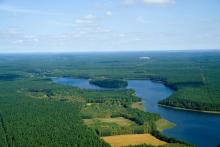
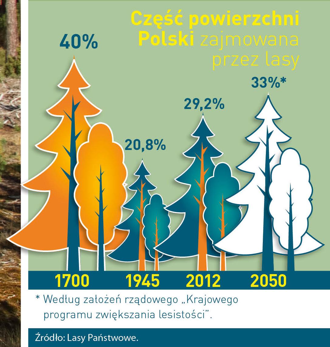
Poland is in the European lead, while concerning the area of all forests. They cover about 29,2 % of the country territory, and grow within the area of 9,1 million hectares. The overwhelming majority of the forests is state owned, of which almost 7,6 million hectares are managed by the State Forests National Forest Holding..
The number of Polish forest is still growing. The forestation rate of the country has increased from 21 % in 1945 to 29,2 % at the moment. Between 1995 and 2008, the forest area increased by 310 thousand ha. The basis for afforestation works is the "National Programme for Increasing the Forest Cover" (KPZL), assuming an increase of the forestation rate up to 30 % by 2020 and up to 33 % by 2050. Polish forests abound in flora, fauna and fungi. 65 % of the total number of animal species live there.
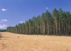
The forests grow in our country on poor soils, mainly because of the development of the agriculture in previous years. It influences the distribution of the types of the forest sites in Poland. Over 55 % of the forest areas is covered with coniferous forests. In other areas, there are forest sites, mainly the mixed ones. Their small part constitute alder and riparian forests – not more than 3 %.
In the years 1945 – 2011 the area of natural deciduous tree stands within the area of the State Forests National Forest Holding increased from 13 to 28,2 %.
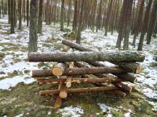
Within the lowlands and uplands the most often occurring tee species is pine. It covers 64,3 % of the forest area of the State Forests National Forest Holding and 57,7 % of private and commune forests. In the mountains the predominant species is European spruce ( in the west) and European spruce with beech (in the east). Domination of pine is the result of carrying on sustainable forest management in the past. Once, the monocultures (crops or cultivations of one species) were the answer to the great demand of industry for wood. Such forests appeared to be quite fragile to climatic factors. They also were often the prey of pests' expansion.
In Polish forests, the share of other tree species, especially deciduous trees have been systematically increasing. The foresters have stepped aside from monocultures – that is why, they try to fit specific species of the forest stand to the natural stand, that would be proper for the given area. Thanks to that, in the years 1945 – 2011, the area of the deciduous tree stands within the lands of the State Forests National Forest Holding increased from 13 to 28,2 %. There occur more and more frequently the following tree species: oaks, ashes, maples, sycamore maples, elms, but also birches, beeches, alders, poplars, hornbeams, aspens, tilias and willows.
Our forests are the most often represented by the forest stands aged 40 to 80 years. The average age of the forest equals 60 years. More and more trees are of big size at the age over 80 years. Since the end of the Second World War, the forests' area has increased up to almost 1,85 million hectares.
Raport o stanie lasów w Polsce 2012
 Asset Publisher
Nabywamy lasy i grunty przeznaczone do zalesienia
Nabywamy lasy i grunty przeznaczone do zalesienia

Lasy Państwowe są zainteresowane nabywaniem lasów i gruntów przeznaczonych do zalesienia
Skarb Państwa – Państwowe Gospodarstwo Leśne Lasy Państwowe Nadleśnictwo Rytel informuje o możliwości nabywania od osób fizycznych lasów i gruntów przeznaczonych do zalesienia, na podstawie przepisów art. 37 ustawy z dnia 28 września 1991 roku o lasach (t.j. Dz. U. z 2025 r. poz. 567).
Jeśli są Państwo właścicielami:
- gruntów leśnych,
- gruntów przeznaczonych do zalesienia w miejscowym planie zagospodarowania przestrzennego lub w decyzji o warunkach zabudowy,
i są Państwo zainteresowani sprzedażą takiej nieruchomości na rzecz Lasów Państwowych, zapraszamy do kontaktu z Nadleśnictwem Rytel. Informacji w tym zakresie udziela Adrian Talaśka – starszy specjalista Służby Leśnej ds. stanu posiadania i mapy numerycznej w Nadleśnictwie Rytel (tel. 52 334 18 59, kom.: 668 037 699, e-mail: adrian.talaska@torun.lasy.gov.pl).
Dla ułatwienia opracowaliśmy dla Państwa wzór oferty sprzedaży nieruchomości, który zawiera podstawowe informacje, niezbędne do dokonania przez nadleśnictwo wstępnej oceny zasadności jej nabycia.
W oparciu o dane z otrzymanej oferty analizujemy położenie nieruchomości oraz jej stan prawny. Jednocześnie, na podstawie oględzin terenowych oceniamy m.in. przydatność gruntu do prowadzenia gospodarki leśnej. Jeśli zajdzie taka potrzeba poprosimy właściciela o uzupełnienie dokumentacji lub przekazanie dodatkowych informacji.
W przypadku pozytywnego rozpatrzenia oferty przez nadleśnictwo, do dalszego procedowania potrzebne będą następujące, aktualne dokumenty:
- uproszczony wypis z rejestru gruntów,
- kopia mapy ewidencyjnej,
- zaświadczenie o przeznaczeniu nieruchomości w miejscowym planie zagospodarowania przestrzennego.
Nabycie nieruchomości następuje po uzyskaniu przez nadleśniczego pisemnej zgody Dyrektora Generalnego Lasów Państwowych.
Po otrzymaniu zgody na nabycie nieruchomości, nadleśniczy zawiera z właścicielem (właścicielami) nieruchomości porozumienie dotyczące zasad przeprowadzenia transakcji, w którym strona zbywająca składa oświadczenie o pokryciu kosztów sporządzenia wyceny nieruchomości przez rzeczoznawcę majątkowego w przypadku wycofania się zbywcy z transakcji po zleceniu tej wyceny przez nadleśnictwo.
W dalszej kolejności nadleśnictwo zleca uprawnionemu rzeczoznawcy majątkowemu wykonanie wyceny nieruchomości. Zgodnie z przepisami ustawy o lasach, cena nabycia nie może być wyższa niż wartość wynikająca z wyceny. Ostateczna cena sprzedaży ustalana jest w drodze negocjacji potwierdzonych protokołem.
Umowa sprzedaży nieruchomości zawierana jest z zachowaniem formy aktu notarialnego.
-------------------------------------------------------------------------------------------------------------------------------------------------------------------------------------------------------
Realizując zapisy Zarządzenia nr 79 Dyrektora Generalnego Lasów Państwowych z 30 grudnia 2021 roku w sprawie zasad powiększania zasobów leśnych w wyniku nabywania lasów i gruntów przeznaczonych do zalesienia przez jednostki organizacyjne Państwowego Gospodarstwa Leśnego Lasy Państwowe, Nadleśniczy Nadleśnictwa Rytel informuje, iż jest zainteresowany zakupem na rzecz Skarbu Państwa lasów oraz gruntów przeznaczonych do zalesienia, położonych w zasięgu terytorialnym Nadleśnictwa Rytel, na podstawie art. 37 ustawy z dnia 28 września 1991 r. o lasach (t.j. Dz.U. z 2023 r. poz. 1356).
Zasięg terytorialny Nadleśnictwa Rytel oraz lokalizację proponowanych do sprzedaży gruntów, można zweryfikować w internetowym Banku Danych o Lasach - https://www.bdl.lasy.gov.pl/portal/mapy. W przypadku trudności z ustaleniem właściwego terytorialnie nadleśnictwa, prosimy o kontakt telefoniczny.
Oferowane do sprzedaży nieruchomości powinny spełniać poniższe kryteria:
- według danych Ewidencji Gruntów i Budynków nieruchomość musi być sklasyfikowana jako las (symbol użytku Ls),
- w przypadku gruntów rolnych muszą one być przeznaczone w miejscowym planie zagospodarowania jako grunty do zalesienia; w przypadku braku opracowanego mpzp powinna być wydana decyzja o warunkach zabudowy na zalesienie,
- powinny być własnością lub współwłasnością sprzedającego (w przypadku współwłasności ofertę muszą złożyć wspólnie wszyscy współwłaściciele),
- uregulowany stan prawny (tj. założoną księga wieczysta, nieruchomość nie może być obciążona na rzecz osób trzecich),
- granice nieruchomości są znane, czytelne w terenie i nie mogą być przedmiotem sporów granicznych.
Zgodnie z ustawą o lasach, las lub grunt przeznaczony do zalesienia może być nabyty między innymi w przypadku:
- jego bezpośredniej przyległości (sąsiedztwa) do gruntu pozostającego w zarządzie Lasów Państwowych,
- regulacji przebiegu granicy polno-leśnej.
Dodatkowo, analizując otrzymaną ofertę, nadleśnictwo dokona oceny przydatności oferowanej nieruchomości pod kątem prowadzenia gospodarki leśnej.
Ponadto Nadleśnictwo informuje, że zgodnie z zapisami art. 37 ustawy o lasach, nabycie lasu i gruntu przeznaczonego do zalesienia może nastąpić po uzyskaniu pisemnej zgody Dyrektora Generalnego Lasów Państwowych. Cena, za którą nadleśnictwo nabywa nieruchomość nie może być wyższa od wartości określonej przez rzeczoznawcę majątkowego. Ostateczna cena sprzedaży ustalana jest w drodze negocjacji.
Oferty sprzedaży zawierające dane pozwalające zidentyfikować nieruchomość (numer działki ewidencyjnej, numer obrębu ewidencyjnego, gmina, numer księgi wieczystej) wraz z podaniem proponowanej ceny sprzedaży, należy składać osobiście w siedzibie Nadleśnictwa Rytel lub listownie na adres: Nadleśnictwo Rytel, Rytel-Dworzec 4, 89-642 Rytel lub pocztą elektroniczną na adres e-mail: rytel@torun.lasy.gov.pl. Po zweryfikowaniu otrzymanej oferty, nadleśnictwo zwróci się o dostarczenie dokumentów z ewidencji gruntów i budynków (uproszczony wypis z ewidencji gruntów i budynków, kopia mapy ewidencyjnej), zaświadczenia o przeznaczeniu nieruchomości w miejscowym planie zagospodarowania przestrzennego gminy oraz przekazania informacji nt. występujących na nieruchomości ewentualnych trwałych naniesień i elementów infrastruktury technicznej (podziemnej, nadziemnej).
W przypadku pytań lub wątpliwości prosimy o kontakt pod numerami telefonów:
+48 52 334 1850 lub +48 52 334 18 59
Informacji udziela Adrian Talaśka - starszy specjalista Służby Leśnej ds. stanu posiadania i mapy numerycznej w Nadleśnictwie Rytel.